Across the three villages and the mountain above them lies a whole world: stone mansions, monasteries from 1400 and 1700, an alpine lake at 1,480 metres and the cave where, myth says, Hermes was born.
The route
From 900 to 1,750 metres
Trikala Korinthias is 144 kilometres from Athens and 119 from Patras. The loveliest route starts where the motorway ends: just past Xylokastro, heading towards Patras, you turn left and follow the signs for Trikala — 24 kilometres through picturesque villages such as Riza, Pellini, Rethi and Dendro.
Trikala is the largest of the villages on the eastern side of Ziria and one of the oldest and best-loved mountain resorts in Greece. Its three neighbourhoods, Kato, Mesaia and Ano, climb to elevations of 900, 1,050 and 1,100 metres. On the site of ancient Mysaion, the sanctuary of Demeter, the village is placed by local tradition in the 10th century, when the people of the lowlands climbed up, driven by raiders, to build in a clean and healthy place.
Each neighbourhood keeps something of its own: in Kato Trikala the Church of Agios Dimitrios of 1697, in Mesaia the Monastery of the Panagia of 1700, and in Ano the stone and timber mansions and the churches of the 16th to 18th centuries. Among them stand out the Notaras mansion, today in ruins and awaiting restoration, and the Church of Agios Nikolaos with its old frescoes, which according to local tradition go back as far as the 10th century.
How to get thereFrom Xylokastro, 24 kilometres and about 40 minutes via the southern mountain route. Directions on Google Maps
Eight stops
Everything worth seeing, in the order you meet it
01
Kato Trikala · 1697
Church of Agios Dimitrios
In the Kato neighbourhood of Trikala, the Church of Agios Dimitrios was built in 1697 and is the first major monument you meet on the way up. What makes it special are its 18th-century frescoes, strongly expressionist in character, rare for a church of that period. Among them is the famous “Akra Tapeinosi”, which on its own justifies the stop.
How to get thereIn the Kato neighbourhood, at the entrance to Trikala, at 900 metres. Directions on Google Maps
02
Mesaia Trikala · 1700
Monastery of the Panagia
In Mesaia Trikala stands the Monastery of the Panagia, built in 1700 by the Metropolitan of Corinth Grigorios Notaras, of the family that gave the mountain most of its monuments. It lies on the route between the two neighbourhoods.
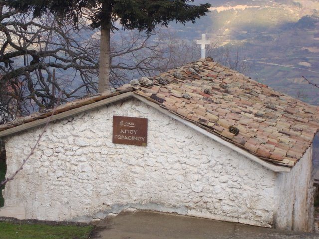
In Ano Trikala stands the Notaras mansion, the three-storey stone house where Saint Gerasimos was born in 1509. It is abandoned and propped up — restoration studies were approved in 2024 — and you can only see it from the outside. Beside it stands the shrine of his birth. The family played an important part in the Orlov Revolt of 1770, in the Revolution of 1821 and in the civil strife that followed. The mansion remains the most tangible sign of its presence in the village.
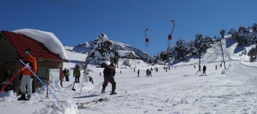
Ten kilometres above Ano Trikala, at an elevation of 1,500 metres, lies the Ziria Ski Centre. It has a 150-metre beginner slope with a baby lift and a second 400-metre run served by a platter lift. The necessary equipment can be rented on site.
On the Ziria plateau many visitors rent snowmobiles or ATVs, or try cross-country skiing, that is, long hiking routes on light snow skis. And when it is time for a break, the wooden chalet serves coffee, a drink or a cold plate every day, with a view over the whole plateau.
How to get thereTen kilometres above Ano Trikala, on a paved road cleared by snowploughs. It usually operates in January and February, for as long as the snow lasts. Directions on Google Maps
05
Elevation 1,480 m · 10 minutes from the ski centre
Lake Dasiou
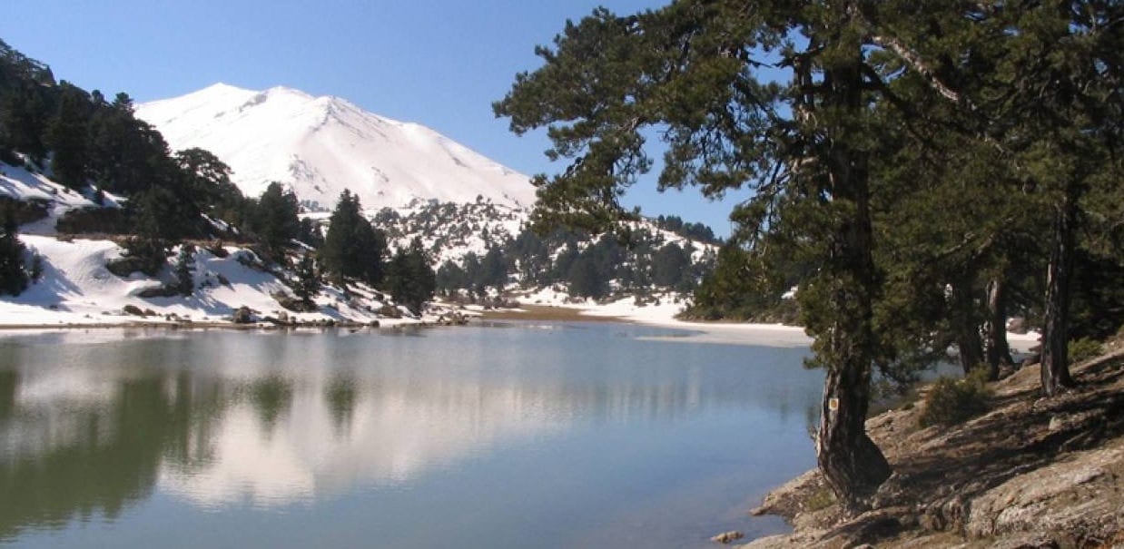
Ten minutes from the ski centre, on the north-western foothills of Kyllini and at an elevation of 1,480 metres, Lake Dasiou is perhaps the most photographed corner of the mountain. Around it, the flora and fauna of Ziria in all their range: fir trees, oaks, violets, mushrooms and wildflowers, along with rare birds of prey, hares, weasels, foxes, even semi-wild horses and cows grazing freely.
Tradition says that around 1400 the miraculous icon of Saint Blasios was found in a nearby cave and a small church was built then; the monastery’s present katholikon dates from the 17th century. During the Ottoman period it served as the spiritual and religious centre of the area. You will find it just past Ano Trikala.
Two small tips: in the garden, at the back of the monastery, the nuns generously offer loukoumades. And from the path that descends to a natural spring, shout whatever you like out loud — the echo always answers.
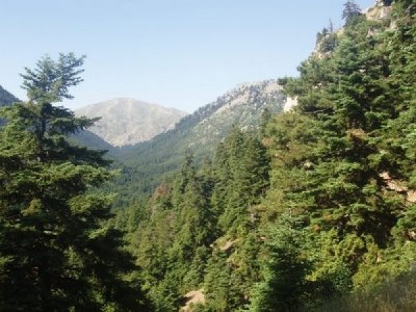
Between Little and Great Ziria lies the Flambouritsa valley, included together with Mount Kyllini in the Natura 2000 network as an area of special interest in need of protection. Crossing it takes you past picturesque streams and centuries-old trees and ends at the springs of the river Sythas.
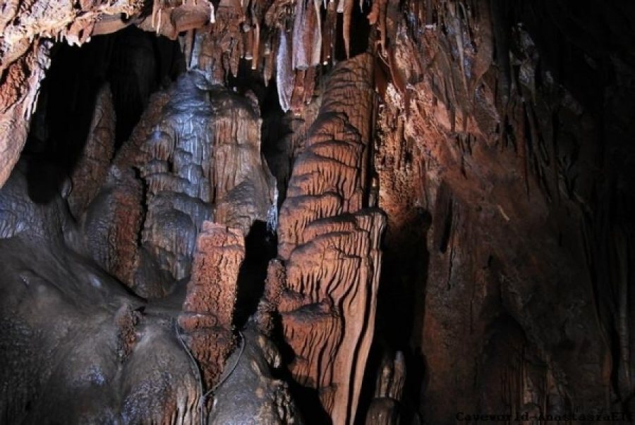
According to mythology, Hermes, son of Zeus and Maia, was born in the depths of this cave — and Maia was one of the seven Pleiades, daughters of Atlas and Pleione. The magical herb “moly” also grew here, which Hermes gave to Odysseus to protect him from the witch Circe.
The cave lies on the western side of Flambouritsa, at an elevation of 1,750 metres. It covers 1,200 sq. m and branches into 10 chambers full of clusters of stalactites and stalagmites. If you want to explore it, you need the right equipment: a torch, rope and caving clothes.
How to get thereAccess only on foot from the Ziria refuge. Specialised equipment required. Directions to the refuge
And then?
What you can do up there
Hiking to the summit, horse riding in Rethi, 4x4 routes on the plateau. See what you can do along the same route.